
On the Conestoga River Water trail section (Brownstown to Safe Harbor) there are 3 dams. Two classify as “low head” dams. The third is a sluice dam. All three of the dams are well marked with signs and have recognizable portages to carry your boat around them.
A low head dam will appear as a smooth line across the water from upstream which makes them particularly dangerous. Be safe, know where they are and avoid the exclusion zone. The exclusion zone for all the dams is 200′ upstream and 100′ downstream.
See additional details below on each of the dams so you can safely navigate around them and continue your trip.
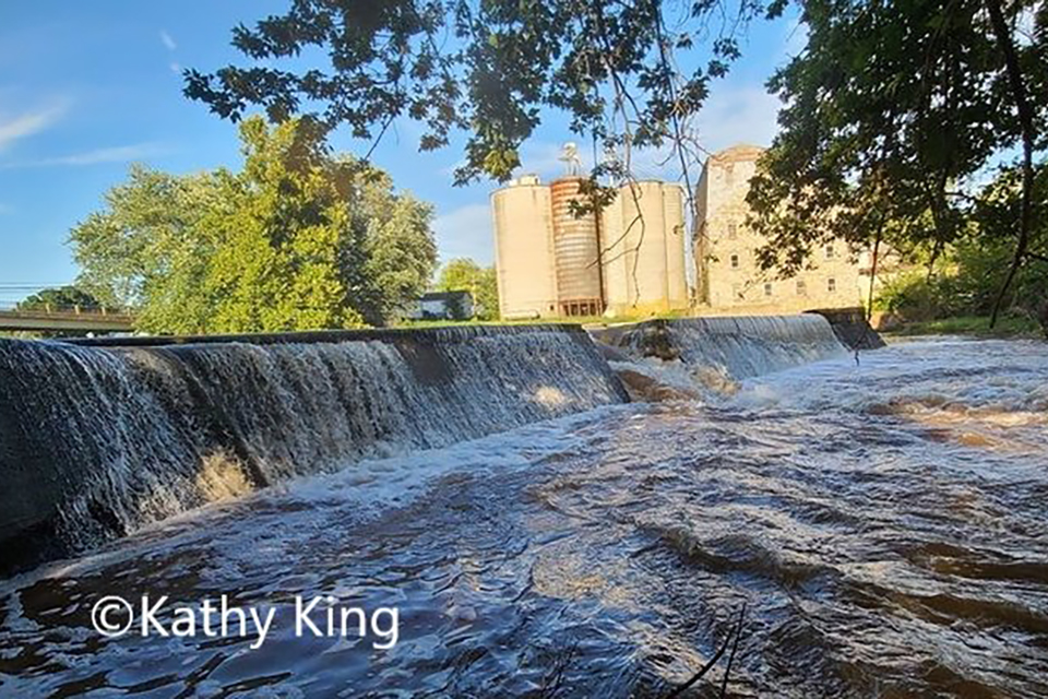
Zook’s Mill Dam
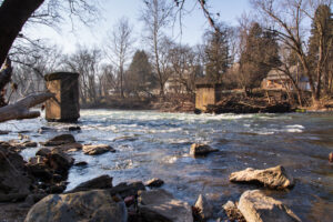
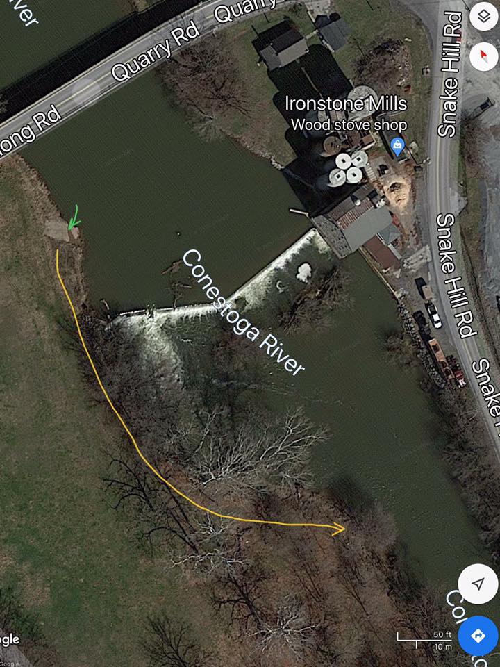
Water Works Dam
The Viaduct Dam

There are five spots where extra caution is encouraged.
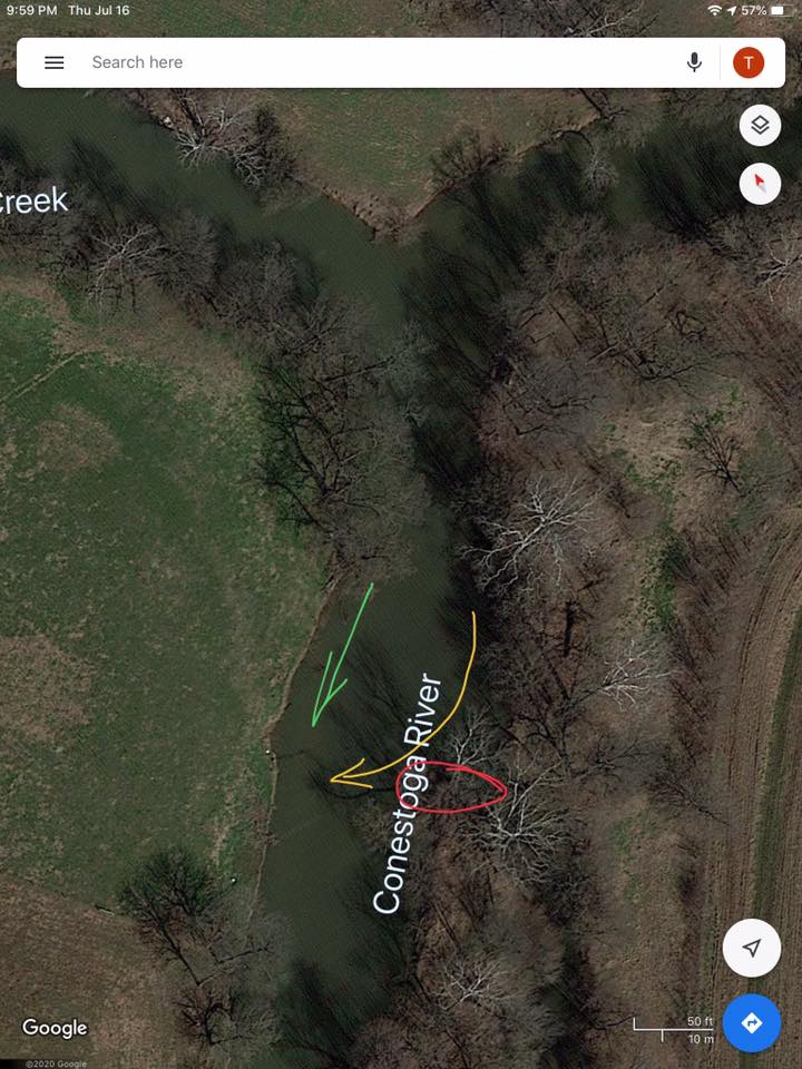
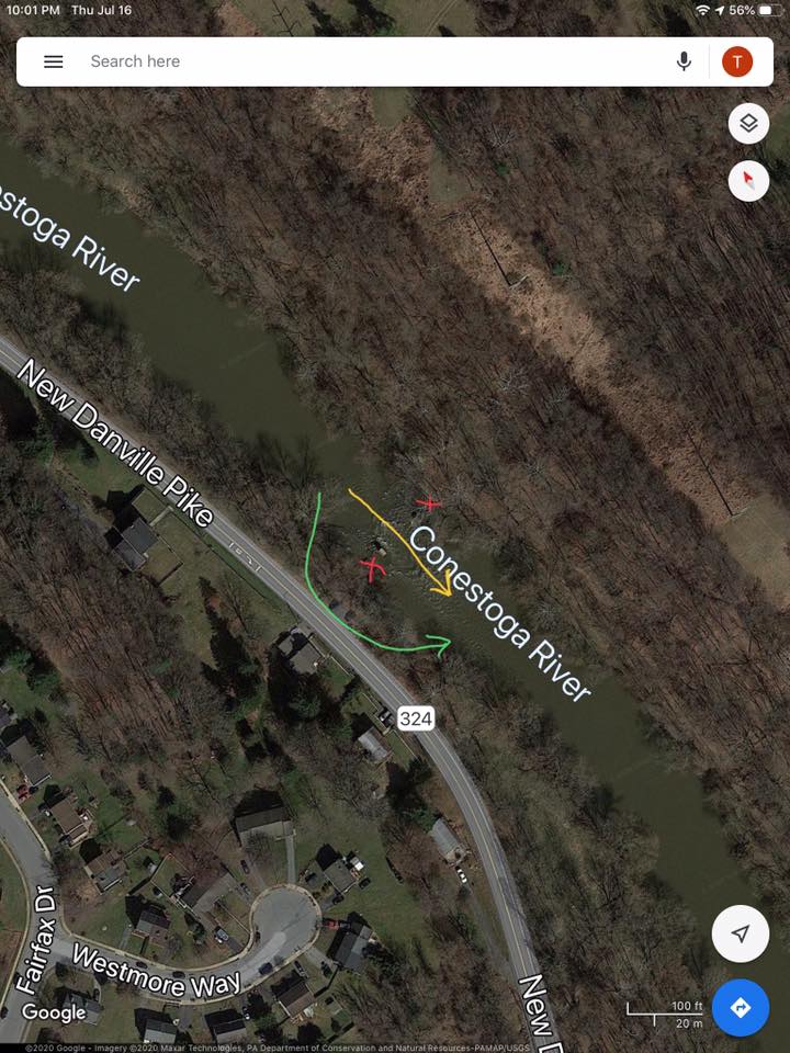
1. Below the Confluence of the Cocalico Creek & the Conestoga
At the convergence of the Cocalico Creek and the Conestoga River, about 50 yards downstream, (40.1143894, -76.2268192) there is a cut-in on river left. The river topography wants to flow into that cut and forces through a shore bound strainer, marked in red. If you follow the yellow arrow and are a strong paddler, you can clear it with ease. Otherwise, walk your boat along the green arrow through the river right shallows.
2. Zook’s Mill Dam
At Zook’s Mill dam take out at the green arrow on river right. Portage around the dam and put back in along the yellow arrow further downstream on river right. (40.1048207, -76.2381277)
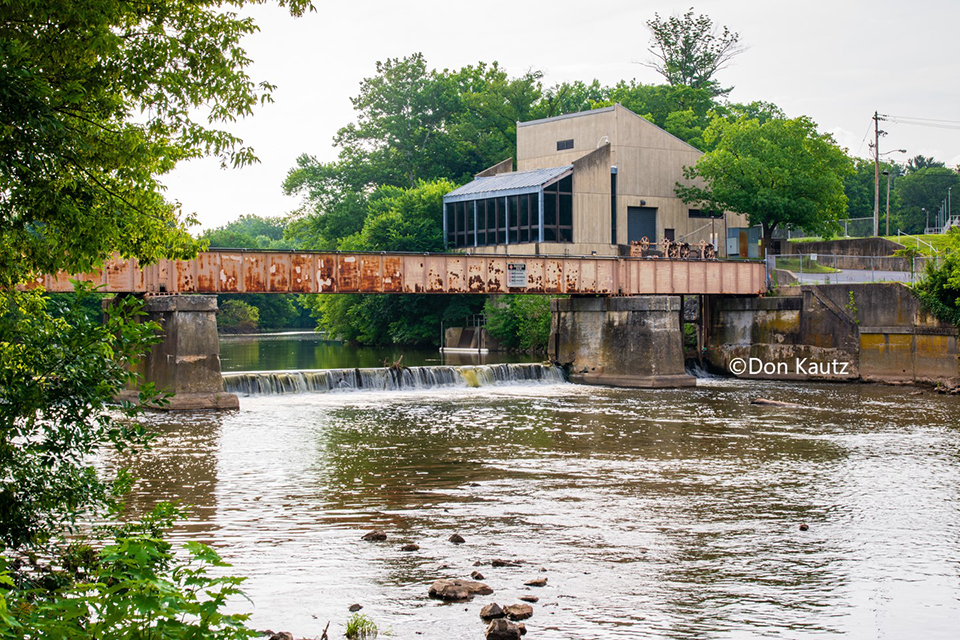
3. Lancaster Water Works
At the Lancaster Water works (40.0510604, -76.2761363) and the viaduct dams (40.0499704, -76.2779927), take out at the green arrow on river right, portage around the dam and put back in at yellow arrow. Paddle to river left and take out at the red arrow, portage and put in at the green arrow on river left.
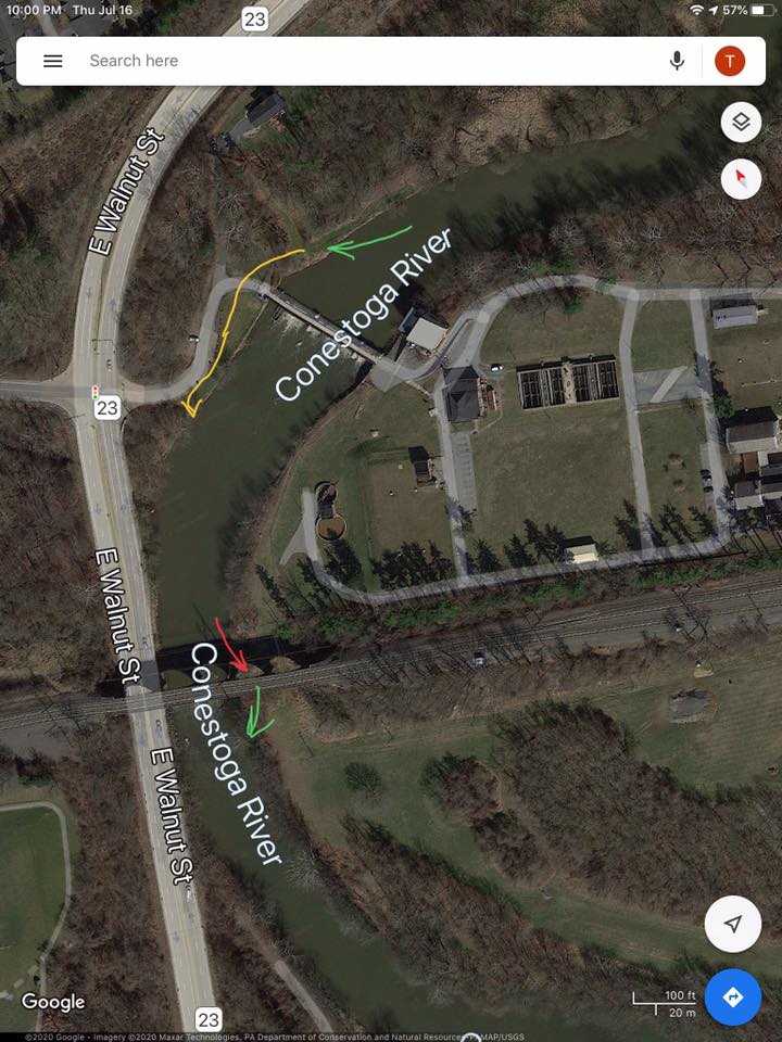
4. Between New Danville Pike & Buchmiller Park
The next obstacle lies between New Danville Pike (river right) and Buchmiller Park (river left) (40.0099674, -76.3030147). If you stay centered between the old trolley bridge uprights along the yellow arrow, the current is swift and there is a 3′ drop with a robust wave train. If you’re uncertain, portage river right along the green Avoid the red areas outright. They are deep, choked with debris, and pose a serious risk.
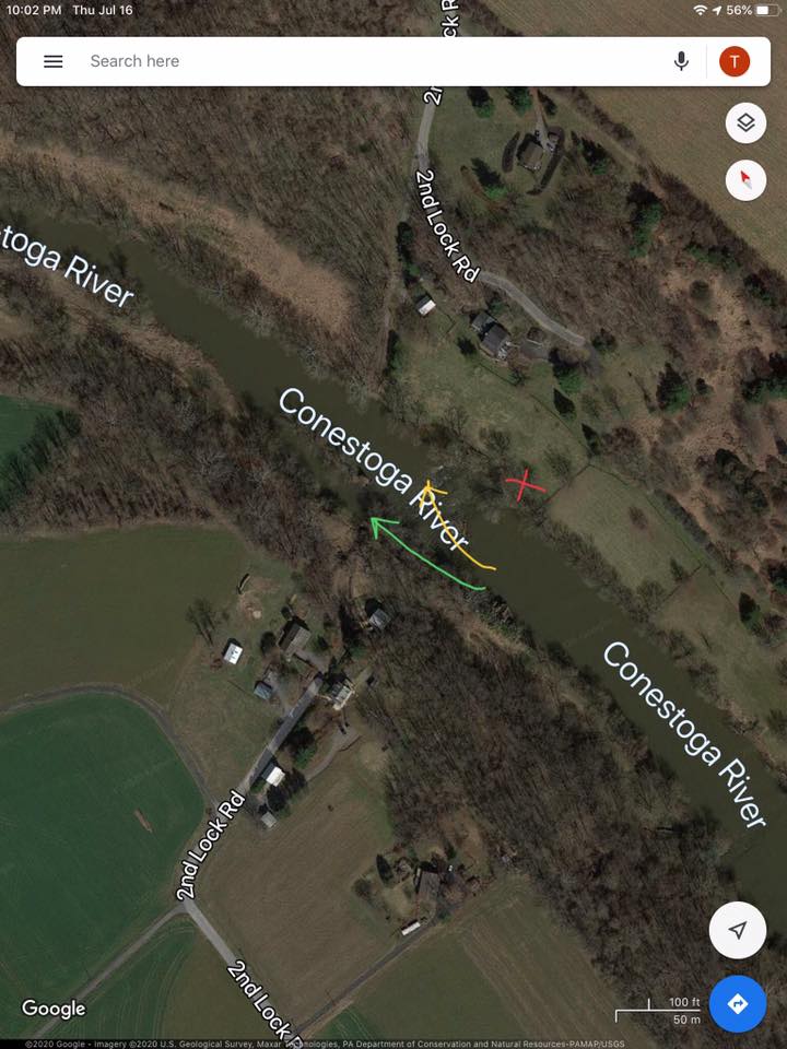
5. Second Lock
This feature is below New Danville bridge about 1/2 a mile (40.0035066, -76.3131005). It’s about 75 yards in length and littered with rocks. The shallower the water, the more challenging and potentially dangerous it can be. Walk your boat along river left if you’re uncertain about navigating the path of the green arrow. Paddle river left towards river right in the general direction of the yellow arrow. Avoid extreme river right.
Note- If you must take out for safeties sake, take out river left. The farm there is more gracious to paddlers than the homeowners on river right.